| Visible Meteosat |
|---|
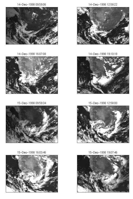
| Meteosat visible imagery for December 14 to 16 shows the creation, development and decay of the storm. On December 14, the cold front is visible south of the continent and connect with a heat low over the interior.Cloud lines over the Agulhas Current on December 14 provide further evidence of the low level moisture available along the southeast coast of South Africa. |
 |
|


[Abstract|
Introduction|
Agulhas Current |
TRMM SST|
Cloud Lines |
Questions|
Synoptic settings.|
Rainfall|
 Visible Meteosat|
Infrared Meteosat|
The Movies|
TRMM Orbits|
TRMM Precipitation|
TRMM zoom|
TRMM vertical section|
Humidity flux 1|
Humidity flux 2|
Humidity flux vertical sections2|
Conclusion|
References
Thanks]
Visible Meteosat|
Infrared Meteosat|
The Movies|
TRMM Orbits|
TRMM Precipitation|
TRMM zoom|
TRMM vertical section|
Humidity flux 1|
Humidity flux 2|
Humidity flux vertical sections2|
Conclusion|
References
Thanks]
Email: rouault@physci.uct.ac.za
Forum