| TRMM Orbits |
|---|
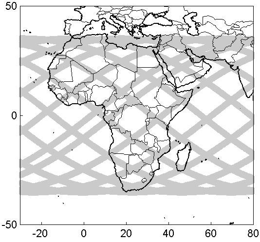
| The TRMM satellite is a joint US-Japan satellite mission to monitor tropical and subtropical precipitation and to estimate its associated latent heating. TRMM provides systematic visible, infrared, and microwave measurements of rainfall in he tropics between 35 N and 35 S and passes over the Agulhas Current region and coastal South Africa four times daily. We are using two rain-measuring instruments: the Precipitation Radar(PR), the TRMM Microwave Imager (TMI) and a combination of the two in that study. The PR is the first rain radar in space and the most innovative rain-measuring instrument aboard TRMM. It has a horizontal ground resolution of approximately 4 km and a swath width of 220 km. One of its most important features is its ability to provide vertical profiles of the rain from the surface up to a height of about 20km. Another feature is the fine ground resolution, however the 4 km wide footprint of the PR is greater than the scale of some convective rainfall cells. The TRMM Microwave Imager (TMI) is a passive microwave sensor designed to provide quantitative rainfall information over a wide swath width of 760 km. The TMI carefully measures the tiny amounts of microwave energy emitted by the Earth and its atmosphere and is able to quantify the water vapor, the cloud water and the rainfall intensity in the atmosphere |
 |
|


[Abstract| Introduction| Agulhas Current | TRMM SST| Cloud Lines | Questions| Synoptic settings.| Rainfall| Visible Meteosat| Infrared Meteosat| The Movies|
 TRMM Orbits|
TRMM Precipitation|
TRMM zoom|
TRMM vertical section|
Humidity flux 1|
Humidity flux 2|
Humidity flux vertical sections2|
Conclusion|
References
Thanks]
TRMM Orbits|
TRMM Precipitation|
TRMM zoom|
TRMM vertical section|
Humidity flux 1|
Humidity flux 2|
Humidity flux vertical sections2|
Conclusion|
References
Thanks]
Email: rouault@physci.uct.ac.za
Forum