Surface Drifters
|
|||
|
Observed velocities used in this study
were obtained from the global surface drifter data archives of the NOAA
Atlantic Oceanographic and Meteorological Laboratory. The instrument
used is the World Ocean Circulation Experiment/Tropical Ocean-Global
Atmosphere experiment (WOCE/TOGA) Lagrangian drifter (Sybrandy and Niiler,
1991) with a drogue at 15-m nominal depth. Drifter velocities were extracted
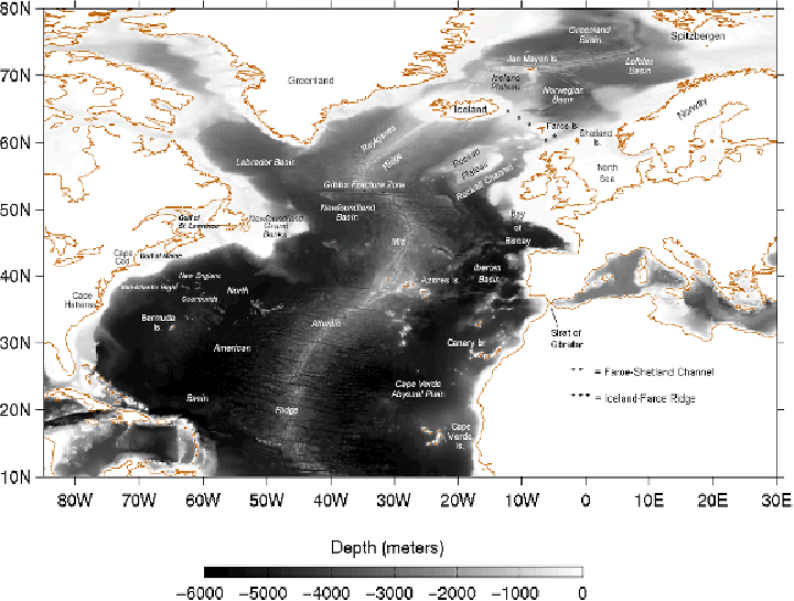
for the years 1993-1997 for the North Atlantic
domain, defined here as 20°N-70°N and 80°W-20°E. The velocities were corrected for drogue slippage
resulting from wind effects using a formula based on regression analyses of a
complete worldwide database of drifters and global wind products (Pazan and
Niiler, 2001). The data were then sub-sampled at daily intervals to match the
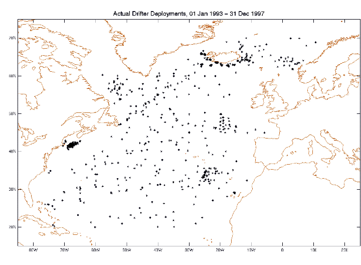
time of the model snapshots. Concentrated releases were
made off Cape Cod and the coasts of Norway and Iceland, between the Azores
and Canary Islands, east of the mid-Atlantic ridge between 44°N and 49°N,
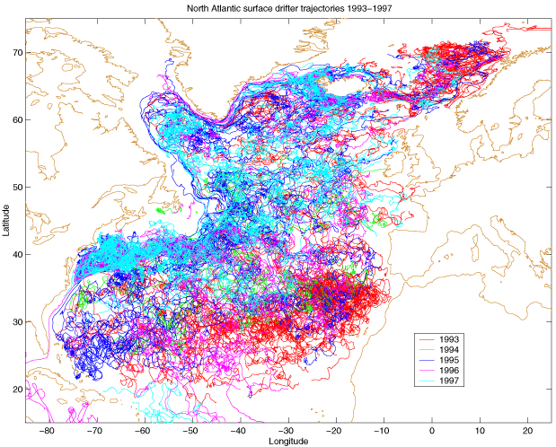
and in the Labrador Sea. The composite trajectory plot reflects the
dispersion from the deployment sites, with high drifter data densities
corresponding to the areas of intense deployment. |
|||
|
|
The drifter trajectories clearly show a coherent Gulf
Stream and northern boundary currents, while the southeast basin is
characterized by circuitous, rambling patterns. The coverage of the open
ocean waters is extensive and few areas without drifter data are apparent.
Particular regions lacking coverage are the western boundary of the Labrador
Sea, the wide continental shelves off Canada, the marginal seas off western
Europe, and over the African shelf. |
||
|
|
|
||
|
|
|||
|
|
|
||

