SYNOP Central Array
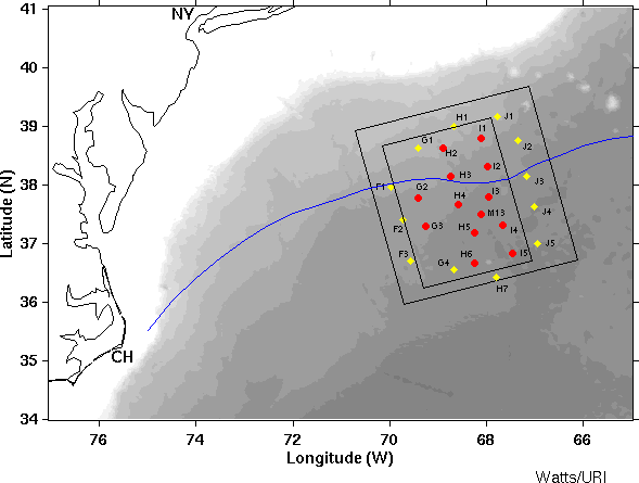
Red circles:
Current meter moorings and PIESs (except M13 which did not have a
PIES)
Yellow diamonds: IESs (no
pressure, no currents)
Small box: Mapping region of pressures and
currents at 3500 m
Large box: Thermocline depth mapping
region
Blue line:
Mean path of the Gulf Stream determined from satellite imagery by Tong
Lee
Bathymetry: 500 m intervals in gray
CH: Cape Hatteras, NC
NY: New York, NY