Summary
 NEW OBSERVATIONAL CAPABILITY: By
combining measurements of bottom pressure recorders and deep current
meters...
NEW OBSERVATIONAL CAPABILITY: By
combining measurements of bottom pressure recorders and deep current
meters...
- we mapped strong abyssal eddies, and
-
demonstrated their coupling to Gulf Stream upper-jet meanders,
as mapped by a coincident IES array.
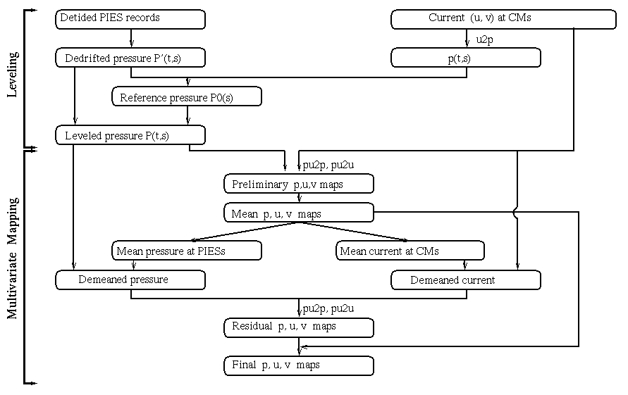
LEVELING of the pressure
sensors was accomplished using directly measured near-bottom currents
(geostrophic)
MAPPING was by multivariate
optimal interpolation (inputs: p, u, v)
MAIN FINDINGS
-
Meanders involve the whole water column as they grow steep
-
Vertical offsets in phase ("tilt") produce growth or decay
-
The abyssal eddies are nearly depth-independent (see below)
-
Gulf Stream rings, in contrast, did not always have a deep influence
- Energetic TRWs propagate through the observing region
NOTE FOR FURTHER THOUGHT
-
The ocean currents in the color-coded cyclones and anticyclones of this
poster are the ocean-equivalent of "storms". We measured and
mapped these features at 3500 m, however they really exert influence
from the sea floor up through the thermocline to the sea surface. Two
good ways to understand why these features are nearly
depth-independent:
- the upper Gulf Stream current adds to the current below it. The deep velocities 'reference' the upper flow through ALL depths.
-
Savidge and Bane (1999a)
examine this topic in detail.
-
The current turns with height because it's the vector sum of deep
eddies crossing the upper-jet flow. This is analogously observed as
"backing" and "veering" in the atmospheric jet
stream.
- Depth-independent flow crossing the upper front drives important cross-frontal exchange (which is the topic of the Lindstrom papers).
SESSION HOME PAGE