|
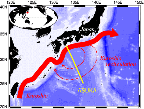
The Kuroshio is the western boundary current of the North Pacific subtropical gyre (Fig. 1).
In situ oceanographic observations along a line crossing the Kuroshio south of Japan were carried out by the Affiliated Surveys of the Kuroshio off Cape Ashizuri (ASUKA) Group.
The observation line was chosen to coincide with a satellite track of the altimeter satellite TOPEX/POSEIDON (Fig. 1).
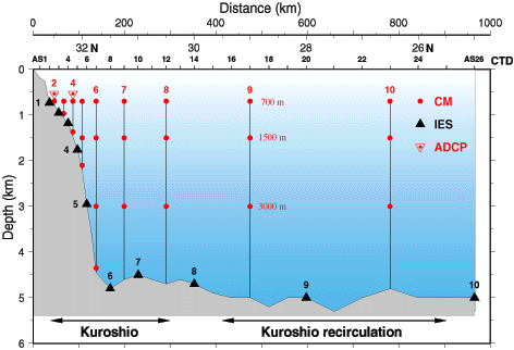
From October 1993 to November 1995, moored current meters were maintained and repeated hydrographic sections were carried out in order to estimate upper layer velocities, which cannot be measured adequately by those moored instruments (Fig. 2).
|


 ASUKA |
Kuroshio transport |
Time series |
Seasonal signal |
References ]
ASUKA |
Kuroshio transport |
Time series |
Seasonal signal |
References ]