|
|
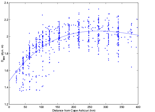
| Variations in D800 along the ASUKA line as determined from CTD/XBT casts taken during the IES deployments. The distance shown is along the ASUKA line (oriented toward 155°True). A SLACTS correction has been applied to the D800 data (dots) and a 4th-degree polynomial (line) has been least-squares fitted to the data. The open circles indicate IES positions. |
BACK |
||||
Abstract |
Introduction |
|||
Dynamic Heights |
Velocities |
Transports |
Conclusions |
References |
Home |